

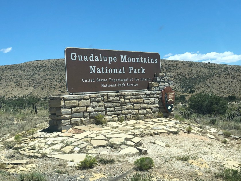
Guadalupe Mountains National Park features the highest peak in Texas and El Capitan, but it is also a wonderful National Park that has a feel of the gateway into Texas from the west. Read more about my visit to this national park.
My dad and I decided to take a three-state road trip as my bachelor party. I’d been with my fiance for 10 years, so the thought of partying in Vegas wasn’t something I wanted to do. My dad is my best man, so when we were discussing what we wanted to do I decided on going to Colorado. At first, we were going to fly, but then I figured it’d be more fun to drive.
In five days we’d drive up to Colorado and back to Austin, but I wanted to see some Texas mountains, so we agreed to stop off at the Guadalupe Mountains National Park on the way.
I had been to Colorado before, so mountains weren’t new to me, but the beauty of El Capitan and the rest of the mountain ranges were a sight to see.
Camping
There are two campsites available here: Pine Springs and Dog Canyon. They each feature spaces for RV campers, but Pine Springs can fit more people. They are on a first-come-first-serve basis, so have a backup plan for your trip during peak seasons. Call ahead if you’re unsure.
Pine Springs offers 20 sites that are fairly remote with small juniper trees that offer little to no shade, but there are some amenities including potable water, restrooms with flush toilets, and sinks for your dishes. No showers here or at Dog Canyon.
Dog Canyon is a little more secluded on the north side of the park. This site has nine campsites by a cliff, so the weather is a little different even in the summer months as it blocks a bit more sun and strong winds. Restrooms here also have flush toilets.
Another great thing about the facilities here is the water filling station. I mean it’s a water bottle filler, but it’s COLD water. Perfect if you’re camping here and need to fill up before a hike. I filled up here.
Again, there is no reservation system here, so you’ll need to find the self-pay kiosk and drop in your $15 for an individual campsite or $7.50 for seniors and Access pass holders.
This is just for camping, so none of the discount cards will work here. Those typically just waive the entry fee.
HIKING
PINE SPRINGS VISITOR CENTER TRAILHEAD:
So I have a confession: we were not there long enough for the peak or any other multi-mile hikes. The only one we had time for was The Pinery Trail which begins right at the visitor’s center.
It’s only 3/4 mile long, but there is a bit of history here. The Pinery features the remains of the Butterfield Trail stagecoach station. Basically a mail route for this part of Texas.

FRIJOLE RANCH TRAILHEAD
The Frijole Ranch Trailhead features three-day hikes: Smith Spring Trail (2.3 mi. roundtrip), El Capitan (11.3 miles roundtrip), Frijole & Foothills Trails (5.5 miles roundtrip).
I bought a print from 59 Parks featuring El Capitan ( Not an affiliate, but if you grab one let me know, I love mine!) I hadn’t been yet, so I felt a little like a poseur, but since I bought it I was more determined to go even more. (I also bought the Big Bend one and haven’t been…yet).
If you clicked it you saw the shot. El Capitan with its chest puffed to the heavens, pushing itself into the clouds, the blue sky. I was so anxious on this trip and wasn’t sure how emotional I would be driving up and seeing this in its true glory, and I pretty much spoiled it.
We decided to skip highway 285 after reading how horrible the road is and opted to skip to Van Horn and then head north. If you’ve been to Van Horn you know of the Threemile and Beach mountains. Well in my excitement I pulled over to take a picture of those mountains. I know… I know.
CLICK TO READ MORE OF MY HIKING ADVENTURES
Eventually, we arrived at El Capitan at Guadalupe Mountains National Park, and I didn’t sob, but there were some emotions at its glory. It’s unmistakable, and laughable that I’d confuse them with anything else in the area.
The entire road in gives you a great shot of its peak, so definitely pull over and take a great shot if you don’t plan on doing the hike up there. The featured photo for this post was done doing just that.
DOG CANYON TRAILHEAD
Dog Canyon Trailhead features Indian Meadow Nature Trail (.6 miles RT), Lost Peak (6.4 miles RT), and Marcus Overlook (4.5 miles RT). You can view West Dog Canyon from Marcus Overlook.
McKITTRICK CANYON TRAILHEAD
There’s a .9 mile road trip nature trail here for a bit of history, but most people are headed to the McKittrick Canyon trail to A) Pratt Cabin (4.8 miles RT) or onto the Grotto and Hunter Line Cabin (6.8 miles RT). Additionally, the Permian Reef Trail (8.4 miles RT) is another strenuous hike featuring over 2, 000 miles of elevation. You can look into the canyon from this structure.
There’s a separate guidebook for this section of the park available at the visitor’s center that I highly recommend. Once I’ve hiked it I’ll revise this post, but for now, check out some of the amazing footage from hikers on sites like YouTube.
SALT BASIN DUNES TRAILHEAD
The Salt Basin Dunes Trail (3.4 miles RT) features 60-foot-high gypsum dunes with plenty of views, but no shade, so take plenty of water.
PINE SPRINGS TRAILHEAD
Three trails make up this trailhead section: Devil’s Hall (4.2 mi. RT), The Bowl (8.5 mi. RT), and Guadalupe Peak (8.2 mi. RT).
Devil’s Hall is a moderate hike but offers some, ugh, Instagram-worthy shots of the Hiker’s Staircase. The area after Devil’s Hall closes from March-August to protect sensitive species. (side note: I don’t mind pictures, I just cringed using that phrase, heh.)
The Bowl is a bit more strenuous coming in at around 6-8 hours for this hike. It’s a high-country hike through a forest, and according to the day-hike guide, a recommended route is hiking Tejas Trail, Bowl Trail, Hunter Peak side strip, Bear Canyon Trail, and Frijole Trail.
Planning on doing the peak? Read what to expect as a first timer.
Guadalupe Peak is the highest peak in Texas. 8, 751 feet above sea level, this hike is a huge draw in summer, but definitely, as it cools off. It’s not for the inexperienced at all. I highly recommend getting some good miles in before making this trek, and I recommend taking more water than you need and plenty of snacks. Carb load the day before and just be ready for a long day.
A good set of trekking poles like these from REI are a knee saver. I’ve had multiple people needing these more for the way down than the way up. I have a separate post on the importance of trekking poles.
This is going to be a multi-post for my extensive road trip. I’ll also showcase BLM camping in New Mexico and talk about camping in the National Forest in Colorado. Please stay tuned and leave a comment if you’ve been to Guadalupe Mountains National Park.
Please share this post with your friends if you think they’d enjoy it!